
Cents Geofencing

Cents is the most integrated laundry business management platforms in the industry. Cents Dispatch allows customers to expand their business through pickup & delivery through advanced route management. Geofencing is a location-based technology that creates virtual boundaries of a geographic area.
My Role & the Team
I lead end-to-end design for this project, collaborating with a product manager, an engineering manager, and a lead engineer.
Scoped the feature with the PM and engineering manger
Worked daily with lead engineer who developed the feature to help implement it
Conducted QA to help refine the feature as it was being built
Conducted usability testing with an alpha group of customers
Problem Statements

Laundromat operators need optimal flexibility and granular control for setting up pickup & delivery routes
Laundry business owners want the ability to service specific addresses to facilitate partnerships with apartment complexes, hotels, or other businesses
Provide the ability to draw polygons on a map in order to create the boundaries of a service area
Combine the existing capability to set ZIP codes as service areas
Allow customers to create service areas based on singular addresses, which was requested to facilitate business partnerships
Provide a map view to visualize and create service areas with granularity
Product Goals
Small business laundromat owners with one to a few stores
Laundromat managers for more expansive pickup & delivery businesses
Users
Legacy Version
The product first released with MVP functionality and had not been iterated on since.
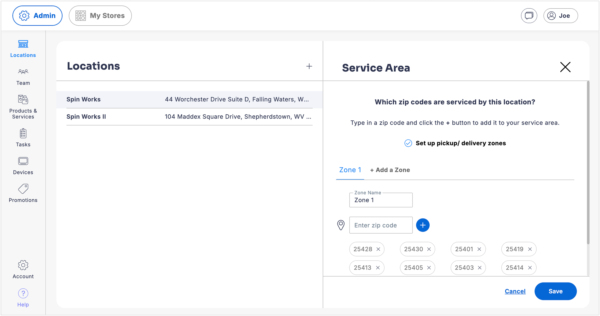
Rigid functionality: Customers were limited to defining service areas by ZIP codes or groupings of ZIP codes
Painpoint: Customers want more granular control than ZIP codes
No map or visual of service area
Old UI built by off-shore engineering team under tight timeline with limited design influence
Wireframe Concept
I went into the project knowing the feature would largely be map-based, but what was that experience like and how did it fit into our existing product?
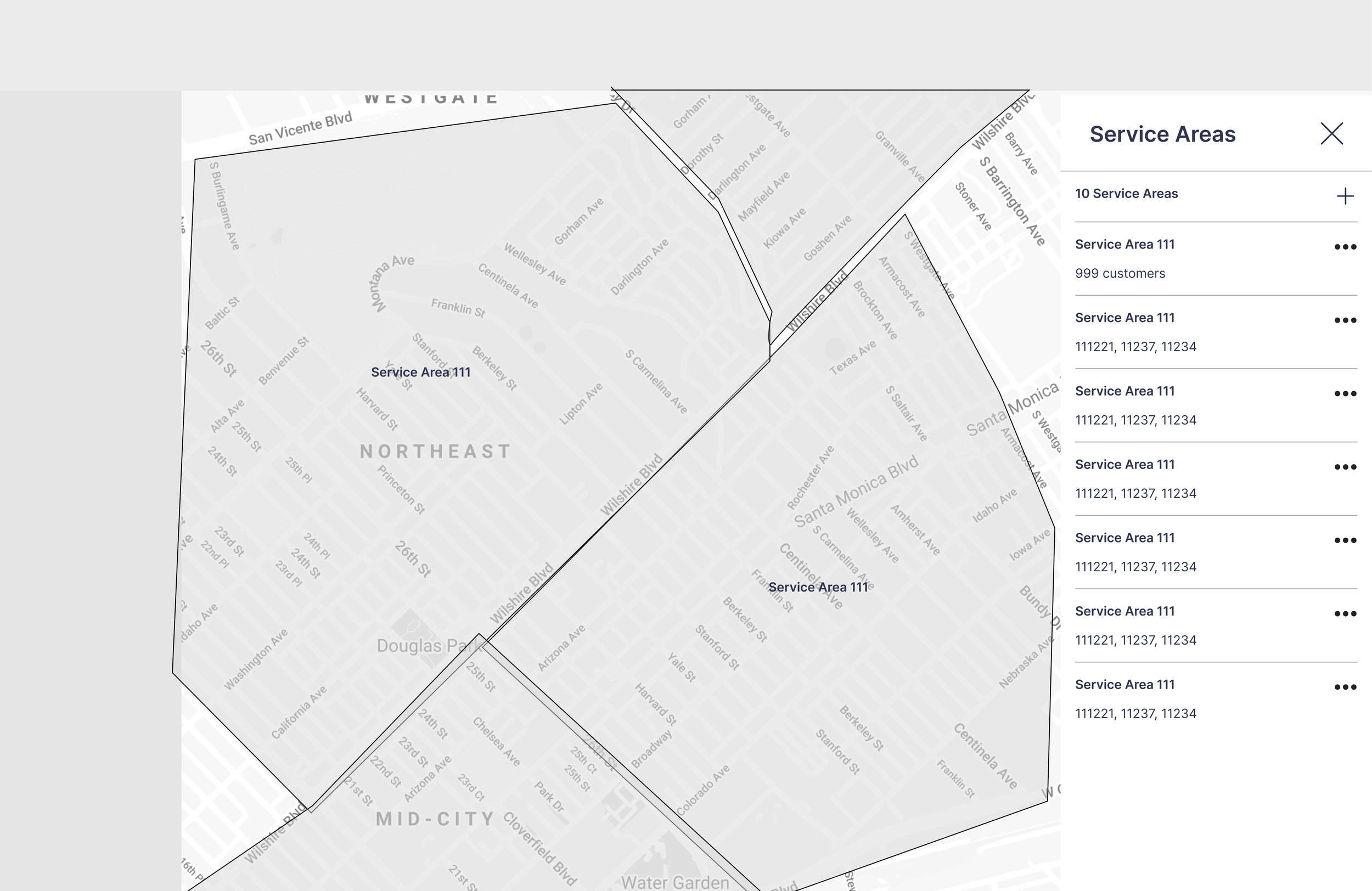
Introduced map-based UI into the product
Map controls to draw geofenced areas onto the map
Right-hand panel to display and input information about the service area
Needed to keep functionality to create service areas by ZIP code to not disrupt the workflow for customers who still wanted to use that functionality
First Iteration
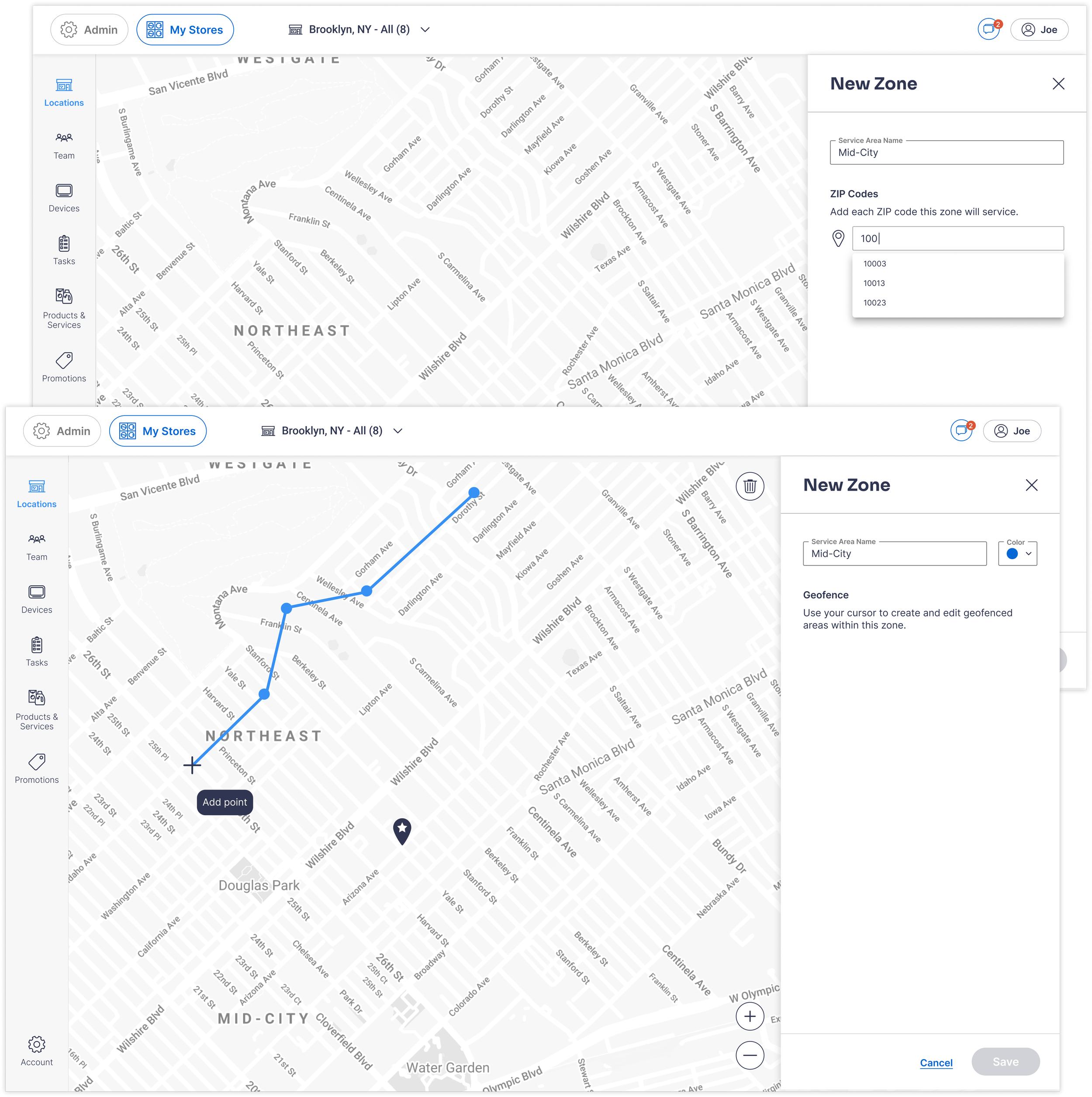
The engineering team decided to implement Mapbox for the base of the map feature and controls.
After communicating back and forth with the engineer to define and fine tune how the map controls worked, we had an iteration ready to user test.
Our first iteration featured a setting to give customers a choice of drawing geofences or simply inputing ZIP codes (as it previously worked).
Geofencing allowed the user to click on the map to create points of a shape.
Closing the shape would create a geofenced area to be named and assigned a color in the left-hand panel.
User Testing: Alpha Group
After refining the design based on my own quality assurance testing in our dev environment, I determined the best way to user test this would be to get this into the hands of real customers setting it up for their business.
I offered a short list of customers who were highly anticipating the feature alpha access under the condition that they set it up on a scheduled call with me which doubled as a usability testing session.
After sessions with 3 customers, I concluded that the feature was largely intuitive and brought joy to those frustrated by the prior lack of flexibility.
Customers were relieved to see the ZIP codes converted into malleable geofences, and were able to easily refine them how they wanted
Instead of clicking the “New Zone” button, customers intuitively tried to click the map to draw a shape opting for a new zone
Room for improvement in the UX copy guiding the user
Uncovered a need fore more customization to service specific addresses within a zone
Since our system could not handle zone overlap, this created a pain point around the sensitivity of the geofence boundaries when creating adjacent shapes
Grayscale color scheme on the map did not have enough contrast to see where the streets were
Key Findings
“I'm excited. I cannot wait to get everything set up and dialed in. I feel like this is going to make my life a million times easier every day.”
“It took me a second to figure out how to draw, but I think if anybody had even the slightest instruction, it would be easy for them to use.”
“It doesn't solve the problem I have right now, having multiple stores that are in the same location or within the same vicinity.”
“The map is too light. I can't
see the roads.”
Second Iteration / Beta Group
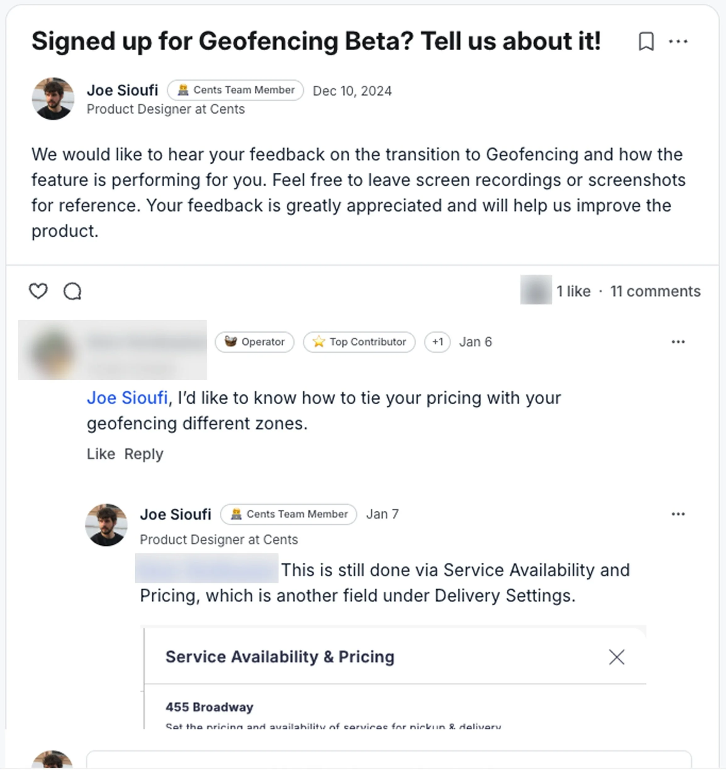
After validating that the alpha release was intuitive and delivered value, we released a beta version to a larger testing group.
We continued to collect qualitative data through both a Slack channel where Customer Success shared feedback from customers, and our Community platform where we engage directly with customers who post about the product.
I continued to iterate on the design and collaborate with the lead engineer based on the feedback collected.
Combining Experiences: A Shift in the Information Architecture
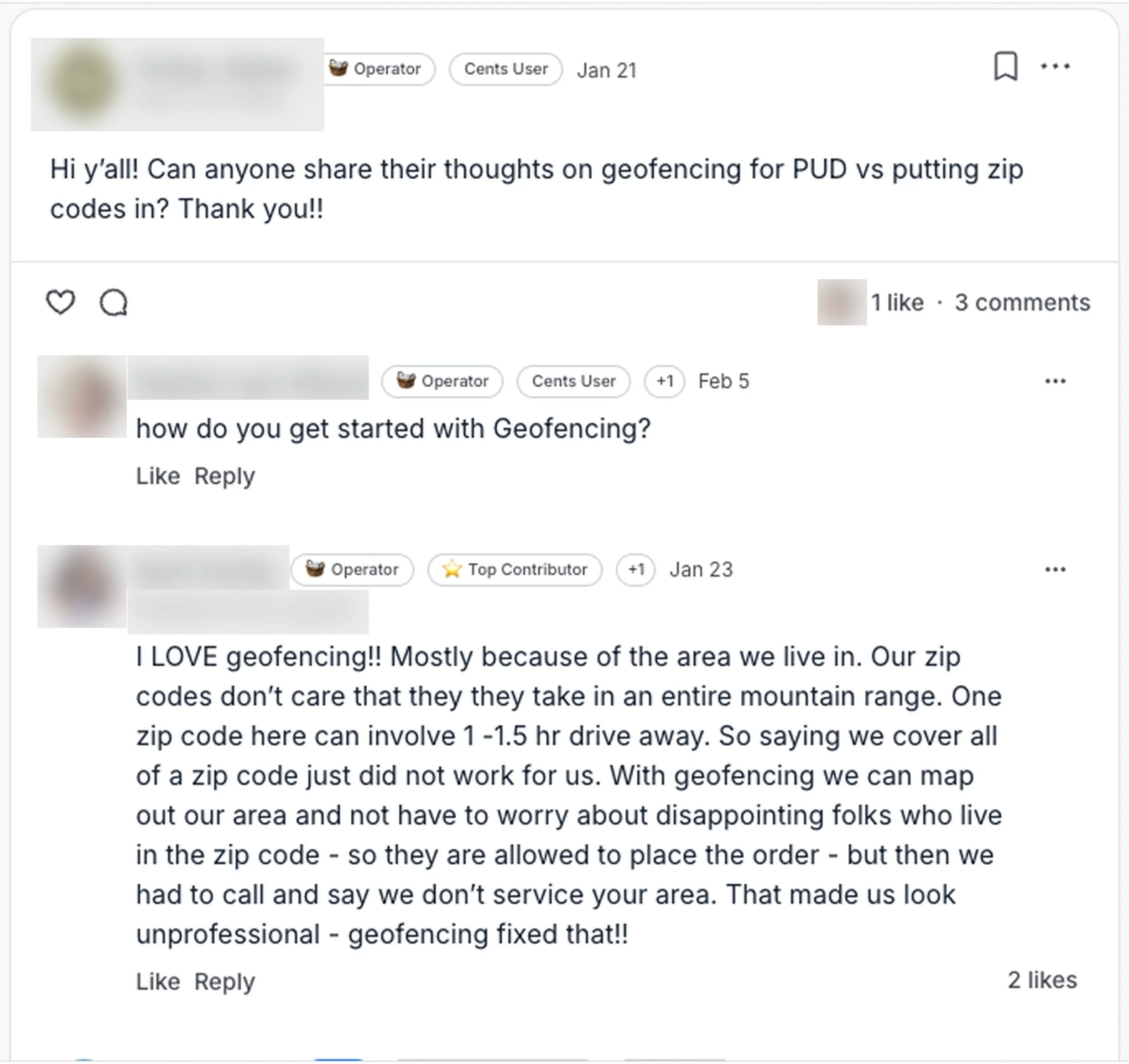
During the beta release, a major painpoint was uncovered: many operators still wanted to create their geofences from ZIP codes and simply edit the boundaries. This was difficult to do using the cursor to draw points for new shapes.
I learned of a customer who tried switching back to the ZIP code setting to add ZIP codes, and then switching back over to the geofence setting again which did not function as intended.
I realized our solution of choosing either ZIP codes or geofencing was too narrow of an approach. We could combine these experiences, and remove the setting forcing the customer to choose only one method.
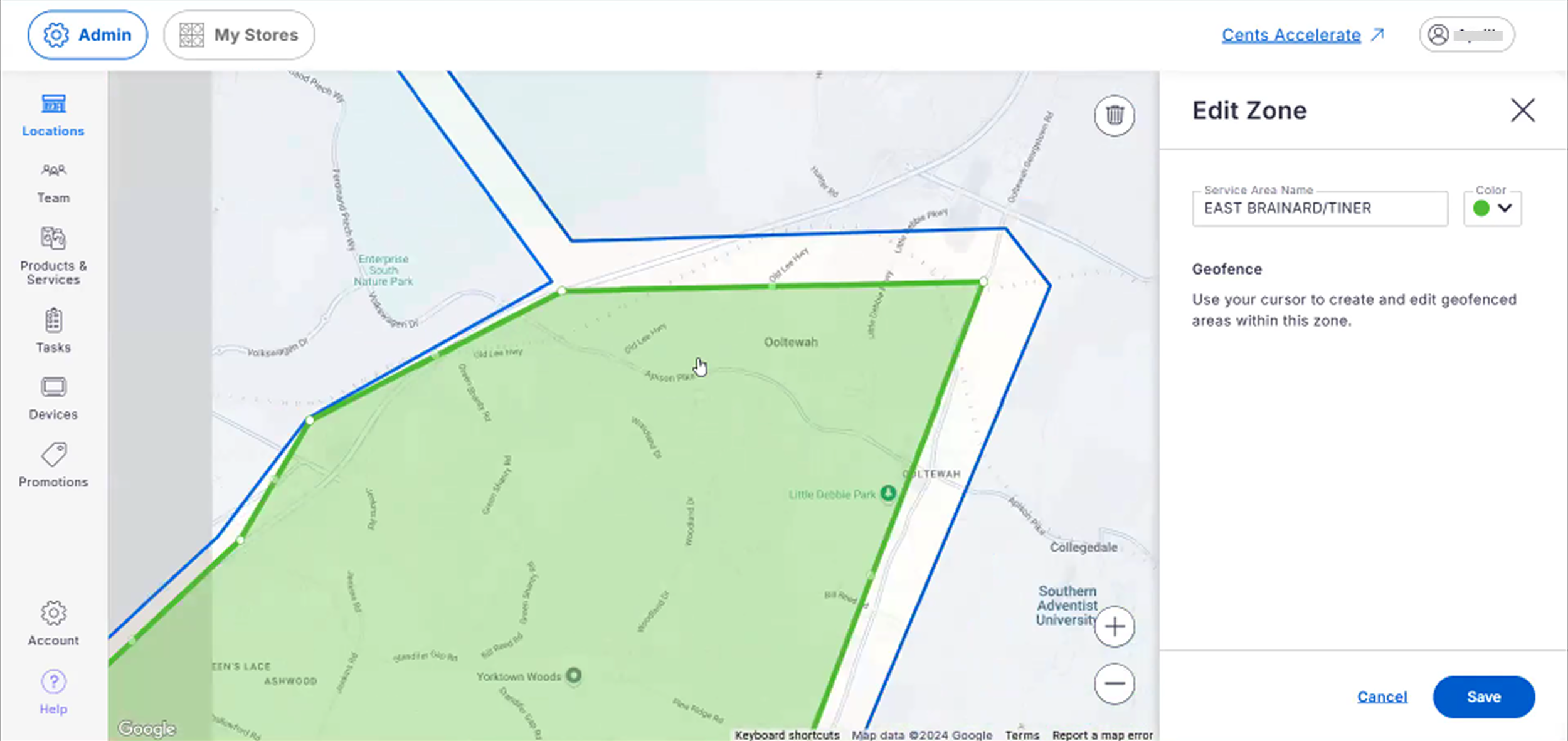
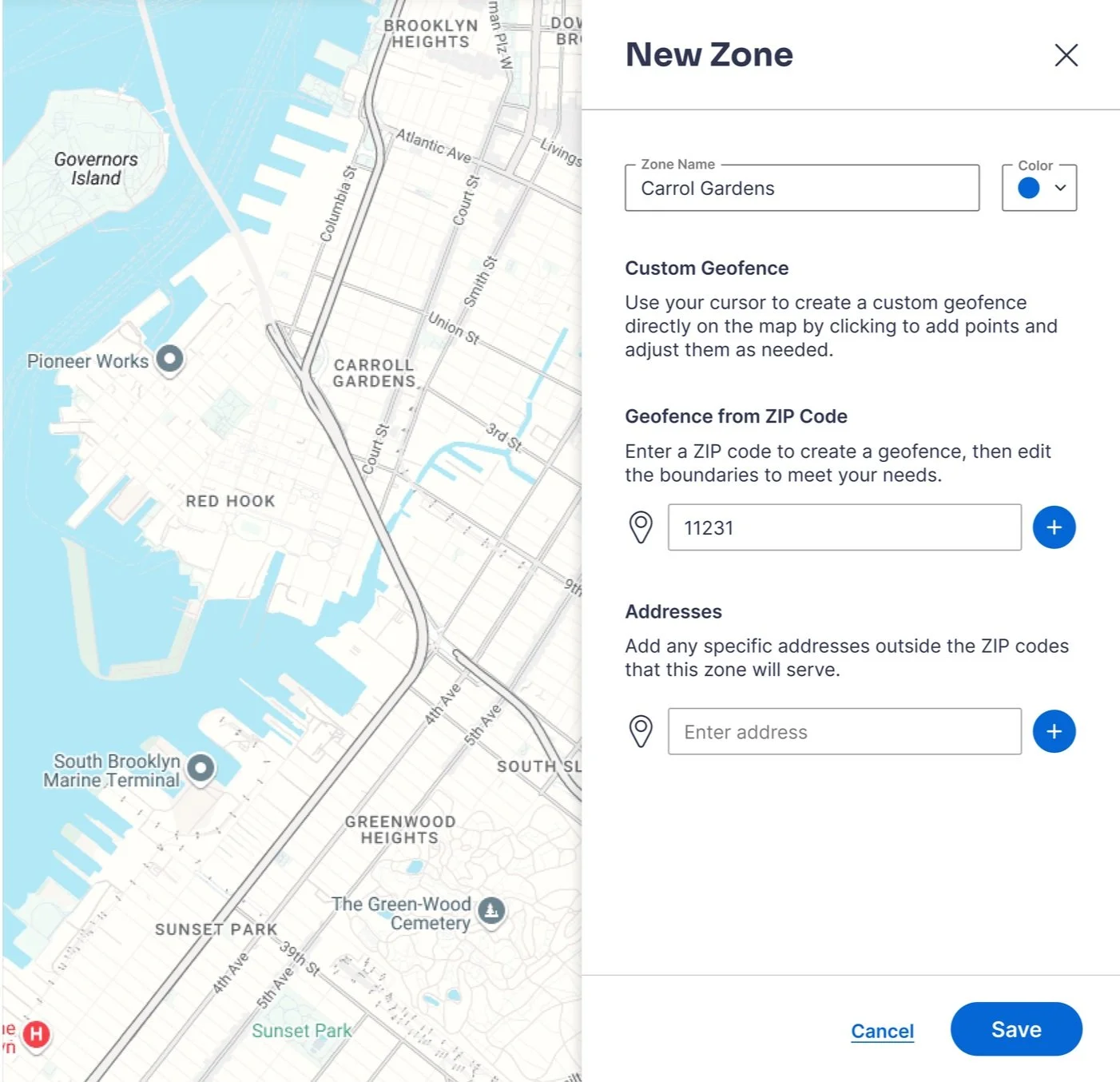
I moved forward with a solution that allowed the user to enter a ZIP code to create a geofence on the map and edit the boundaries.
General Release Demo
Showing customer addresses on the map for reference
Being able to show city / ZIP / county boundaries on the map
The functionality to track and display which ZIP codes were a part of each geofence
